


Topography APP
Mô tả của Topography APP
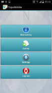
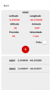
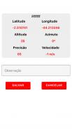
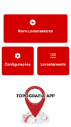
The Topography APP is an excellent application for georeferencing or land surveying, design of electrical networks, avenues, streets, subdivisions and studies in general.
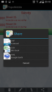
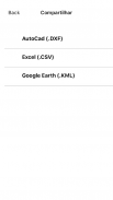
Export your surveys to DXF (Autocad), KML (Google Earth), CSV (MS Excel) without the slightest difficulty and the possibility of transmission by email of their withdrawals directly from the field to the office.
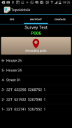
In the Professional version you can mark up to 5000 points for surveys.</div> <div jsname="WJz9Hc" style="display:none">Các Địa APP là một ứng dụng tuyệt vời cho georeferencing đất khảo sát, thiết kế mạng lưới điện, đường, đường phố, phân khu và các nghiên cứu nói chung.
Xuất khẩu các cuộc điều tra của bạn để DXF (Autocad), KML (Google Earth), CSV (MS Excel) mà không có chút khó khăn và khả năng lây truyền qua email rút tiền trực tiếp từ các lĩnh vực văn phòng.
Trong phiên bản Professional, bạn có thể đánh dấu lên đến 5000 điểm điều tra.</div> <div class="show-more-end">
Topography APP - Phiên bản 2.3.4
(16-05-2020)Topography APP - Thông tin APK
Phiên bản APK: 2.3.4Gói: aguiar.com.br.point_gpsPhiên bản mới nhất của Topography APP
Phiên bản khác


 3.55
3.55


Ứng dụng cùng danh mục

Bạn cũng có thể thích...


